Category Archives: Upcoming Events

Upcoming Events

Update July 2019

After a fairly quiet period, SOMR is again attending to several issues affecting the health of the Macleay River:

Report on Nulla Creek and Styx River State Forests Logging inspection 29 – 30 June 2019 by Arthur Bain
How does logging impact our waterways? SOMR’s approach is to go out and take a look, which is what we did in the last weekend in June.
We explored a Nulla Creek resident’s concerns regarding “devastating” logging in Nulla Five Day State Forest. We found no evidence of Forestry Corporation logging activity in the Nulla Creek area.
We then investigated recent, proposed and current logging operations of compartments in the Styx River State Forest, with harvest plans provided by Forestry Corporation of NSW. We were able to get a good picture of the impacts in the Styx. It’s not pretty. With our brief being focussed on impacts to waterways, we have concerns about logging into gullies, from both past and current operations. – We will be bringing this to the attention of relevant agencies.
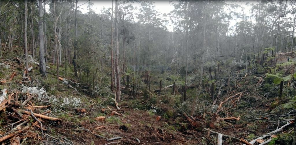
Logging a “Non-Regrowth” compartment at Styx River State Forest – photo by Rupert Milne Home

In early April SOMR committee members were guided to sites selected by Forestry Corporation officers In Tamban State Forest.  They were shown recent recent intensive operations and regenration sites. For more details go to https://saveourmacleayriver.com/

Report on Comara Station intensive farming inspection, 29 – 30 June 2019 by Christa Schwoebel.
During recent months, the SOMR committee had been told of residents’ concerns about sudden stock increases on a cattle station upriver. Overstocking, especially during drought conditions, can lead to land degradation, soil erosion, damage to watercourses and water pollution.
We had also heard about high mortality rates of stock. Carcasses had reportedly been seen in a creek bed.
So, on the weekend we went upriver, we stopped to have a look at herds grazing near the road, which looked in reasonably good condition although there is hardly any feed on the ground. At first glance, we couldn’t see dead animals, but at a closer look we found a carcass in a creek bed, another one top of a ridge with crows feeding on it, several others in dry shallow watercourses. Overall, a very upsetting and unacceptable situation.
We are now gathering further information and have contacted authorities with our photographic evidence. There are a number of agencies involved in the registration and monitoring of livestock, such as Kempsey Shire Council (KSC), Local Land Services (LLS), Environmental Protection Authority (EPA), Meat and Livestock Australia (MLA), Department of Primary Industries (DPI) and not least RSPCA.
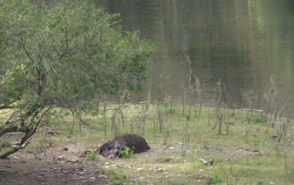
Carcass in the creek bed near Five Day Creek Bridge – photo by Christa Schwoebel

SOMR is also looking into the legalities of clearing on steep slopes and irrigation near the Macleay River.

Hillgrove Mine News
While in care and maintenance for 2½ years, the Hillgrove Mine was up for sale. 
On 3 July 2019, Peter Hosking who has been liaising with SOMR over the years informed us about the completion of the sale.

On the same day Australian Mining reported:
“Red River Resources will acquire the shuttered Hillgrove gold-antimony project in New South Wales from Bracken Resources for $4 million in shares.
Hillgrove has received more than $180 million in investment since 2004 from previous owner Straits Resources and Bracken, which acquired Hillgrove from Straits for $33.2 million in 2013.
Red River managing director Mel Palancian said  (…)
“We love gold and bringing mining assets back to life cheaply,”Palancian said. “It’s rare to find a high-grade gold asset that is close to production with quality resources and infrastructure.”
https://www.australianmining.com.au/news/red-river-to-restart-hillgrove-gold-site-following-acquistion/
Further information coming soon.

Paddle on the Macleay 2019
The committee is currently discussing this year’s Paddle.  We are planning to hold the event in late September.  With water levels in the Upper Macleay being unreliable, we are considering the section from Nelsons Wharf to Kempsey Riverside Park.  The suitability of the launch side needs to be investigated before a final decision can be made at the general meeting following the AGM.

SOMR Annual General Meeting
The AGM will be held on Saturday 3 August 10.30at the Kempsey RSL Boardroom.  All members are welcome.  

Paddle on the Macleay 2018

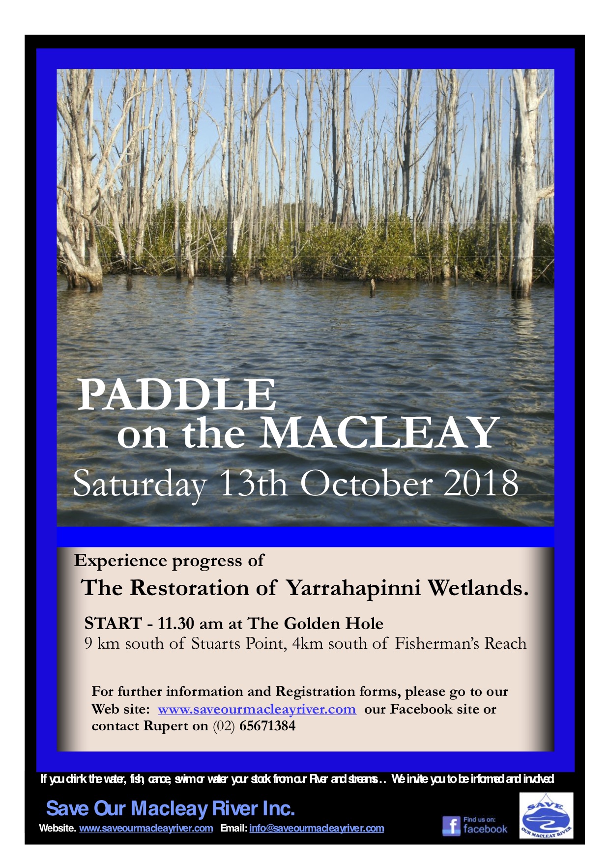
On October 13th, Save Our Macleay River (SOMR) will hold an event to promote awareness of developments and progress of the restoration of Yarrahapinni Wetlands and reduced Acid Sulphate and low dissolved oxygen pollution, as well as create an awareness of Antimony/Arsenic hot spots on the Lower Macleay

Bring your canoe, food and water for an informative, enjoyable day on Saturday October 13th to the Golden Hole 10km south of Stuarts Point by 11.30am.

Paddeling the little known Yarrahapinni Wetlands, participants can witness the restoration from artificial freshwater wetland to its natural salt water one and see the change in vegetation from Swamp-Oak to Mangrove. The re-introduction of tidal salt water has resulted in a massive reduction in Acid Sulphate and low Dissolved Oxygen pollution from the wetlands area and resulted in restoration to a significant fish nursery habitat.

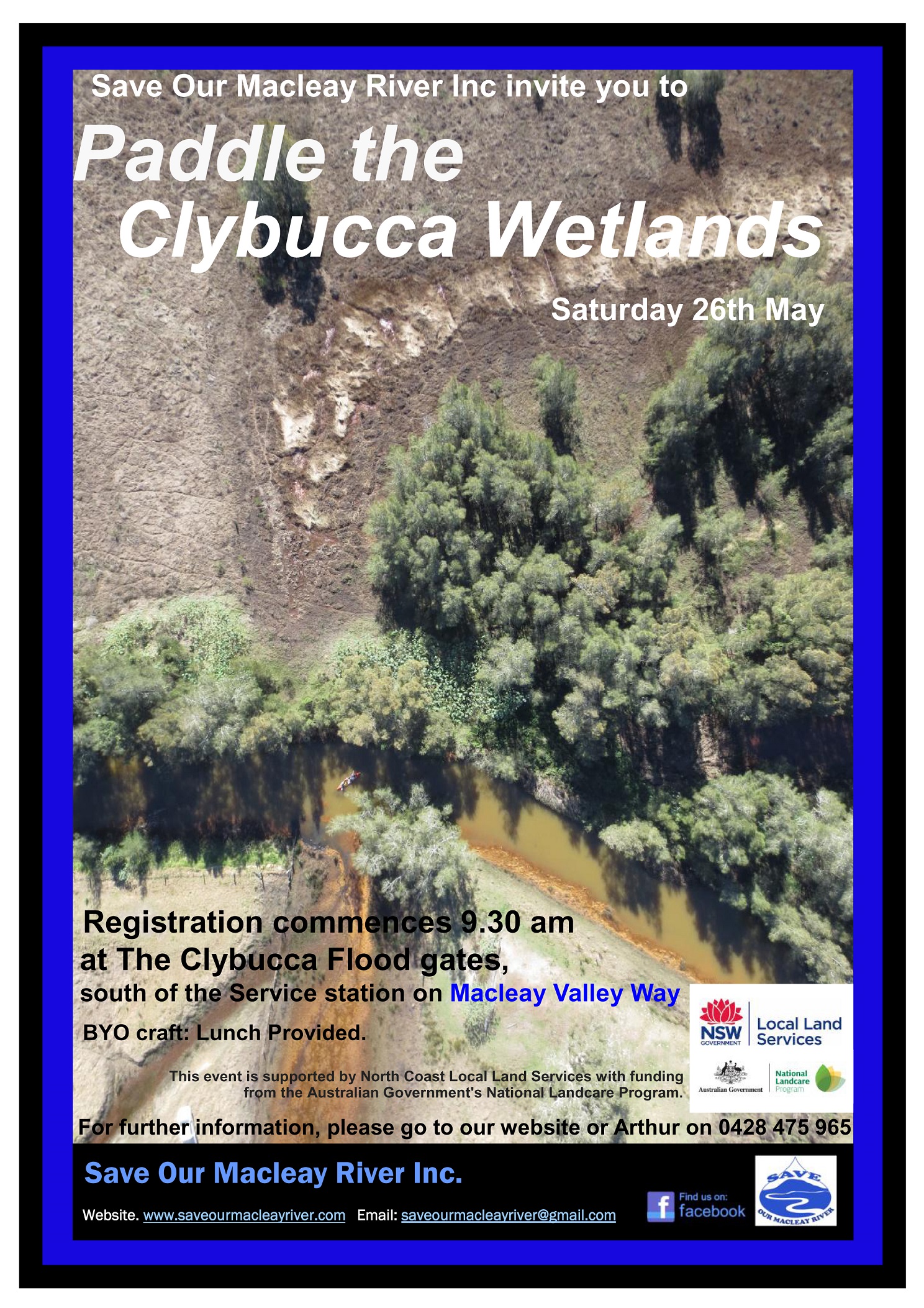
The paddlers will also hear about the proposed Clybucca Wetlands restoration with similar issues, as well as Antimony/Arsenic impacts on the river and ‘hot spots’ in the estuary flood-plain.

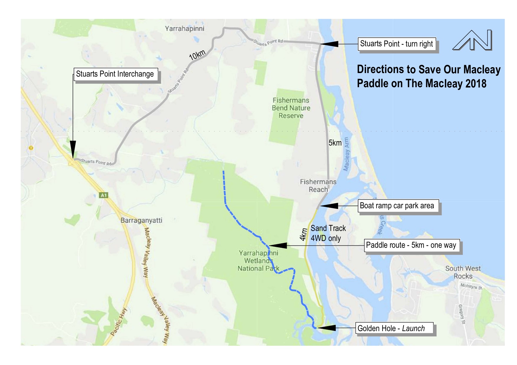
The Paddle will go from The Golden Hole launch area, 9km south of Stuarts Point, to the top of the tidal extent of the Yarrahapinni Wetlands National Park and return the same way. The Paddle starts through the ‘Broadwater’, winds up the narrowing Borigalla / Barraganyatti Creek, past the old ‘Scalds’ area and up the old cut drain to the Whalan’s Bridge Area.

  • Paddle is about 5.5km each way, with incoming and outgoing tide, estimate about 1.5 to 2.0 hours each way.
  • Registration Form: Available below (scroll down to end of this post) and on facebook for pre-filling or completion on the day.
  • Registration Fee is $5.00 per person – to cover insurances – payable at registration before launch
  • Paddlers to bring safety equipment of life jacket, hats, sunscreen, insect repellent etc.

Due to inaccessibility

  • Paddlers to also bring: All food, water/drinks, etc as the area is too inaccessible for SOMR to provide same
  • No toilet ‘facilities’ will be available, paddlers need to follow appropriate bush/camping protocols.

Directions to The Golden Hole launch area for the 2018 Paddle

For pdf print version scroll to end of this post

  • Coming north or south on the Pacific Highway (A1) exit at the Stuarts Point Interchange and from the eastern roundabout take the Stuart’s Point exit.
  • Follow the signs to Stuarts Point and at the end of the road though the village, just past the shops, turn right toward Fishermans Reach for approximately 6km on bitumen road to the Boat Ramp area – where the bitumen ends!
  • At this point, there will be SOMR representatives to provide detailed directions. If 4WD drivers’ can; please offer to assist with transfer of those with 2 WDs.

For those with 2WDs or those wishing transport to the Golden Hole – Arrive at Fishermans Reach by 10.30am:

  • Stop here and find a safe parking area, that will not obstruct others or residents.
  • Approach a SOMR representative and ask for transfer to the Golden Hole launch-site.
  • Please ensure you have gathered ALL your ‘necessaries’ for easy loading, as asked by a SOMR representative. (This to include: hat, sunscreen, life jacket, water, food, car keys, $ for registration fee, etc. – And of-course your canoe and paddle!)

For those with 4WDs, directions will include:

  • Continue past some houses on the right and keep going take one of the sand tracks under the powerline for about 3.5km.
  • At the fence-line, take the right-hand track into the Yarrahapinni Wetlands National Park westwards. (Please do not leave this track. – To protect the highly significant ‘middens’ in this area.)
  • Continue along this track until you reach ‘The Golden Hole’ and please park as directed, for assembly prior to launch.

Click for print version of indemnity/registration form with info summary Paddle 2018 Registration/Indemnity and DirectionsMap2018