to an
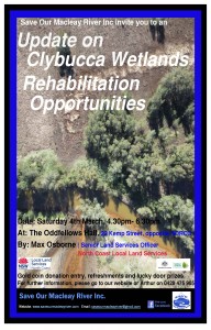
UPDATE ON CLYBUCCA WETLANDS REHABILITATION OPPORTUNITIES
Date: Saturday March 4th – 4.30pm to 6.30pm
Venue: The Oddfellows Hall, 22 Kemp Street (opposite NORCO) West Kempsey
Presenter: Max Osborne, Senior Land Services Officer, North Coast Local Land Services
Cost: Gold coin donation
Clybucca Wetlands is a large area of land, some 10 km² kilometres or 10,000 ha, on the northern side of the Macleay River floodplain. It lies east of the hills, west of Yarrahapinni Wetlands and is divided by the new Pacific Highway dual carriageway.
The Clybucca wetlands has been described as an “Estuarinescape Twilight Zone” by those who are exploring opportunities for its rehabilitation. The wetlands, including Mayes and Doughboy Swamps have sections which are at or below sea level, were once thriving wetlands and drought-poof refuge pastures for graziers prior to being modified by drainage, particularly in the 1960s to 70s under the extensive flood mitigation and drainage scheme.
The drainage and gates installed causes the Acid Sulphate Soils (which are found below the alluvial topsoil) to dry out during times of low rainfall. When “re-wetted” by rainwater, acid run-off along with often water containing low levels of dissolved oxygen flows into the estuary. This discharge, combined with resultant iron leachate/flock and other dissolved metals such as Aluminium, severely degrades water quality, impacting fishing and oyster industries, quality of pasture and soil health, tourism potential, and biodiversity.
Max Osborne, Senior Land Services Officer with North Coast Local Land Services, collaborating with a government inter-departmental working group, has been working towards rehabilitating this significant area of back-swamp and wetlands for the past 3 years.
SOMR encourage you to attend the presentation to see what ‘behind the scenes’ progress has been made and the opportunities for future progress.
Please support and share what is potentially a rare ‘Good News’ story, endeavouring to bring Clybucca Wetlands from the “Twilight Zone”- Back to functioning wetlands, with improved water quality, estuary dependent industries, recreational opportunities and healthy environment.
The progressive restoration of the smaller Yarrahapinni Wetlands to the east and downstream has shown that restoration is not only possible but happens relatively quickly. It is now a thriving estuarine wetland with greatly improved fish and bird habitat and with regenerating mangrove and saltmarsh Endangered Ecological Communities.
This project is supported by North Coast Local Land Services, through funding from the National Landcare Programme and Catchment Action NSW
For a print version of the poster go to Clybucca Update Poster_2017-02-20-MSpdf
Hillgove Mine News
Operations are still on hold while some exploration for viable gold deposits is carried out.
In 2015 Hillgrove Mines lodged a DA to expand mining operations to Clarks Gully. The site is part of the Hillgrove Mine lease. The proposed development would allow continuing mining after the orebody at the current excavation site is depleted. SOMR lodged a submission detailing concerns about the effects of the work on the health of the Macleay River catchment (see the post on this website October 2015)
18 months after submissions were lodged with the then Dumaresq Armidale Council, the application will finally come before the newly amalgamated Armidale Regional Council’s meeting on Wednesday,1 March.
In preparation for the Council meeting there will be a site inspection on Monday, 27 February. Anybody who lodged a submission can attend. SOMR President Arthur Bain will speak about our concerns at the Council meeting.
Read the presentation: SOMR Presentation to Armidale Regional Council and reporting in the Armidale Express http://www.armidaleexpress.com.au/story/4501916/council-grants-conditional-approval-for-hillgrove-mine-expansion/

