Forest Visit

Concerns were raised with SOMR about the impact of the new Integrated Forestry Operations Approval (IFOA) system on water quality in the Macleay Catchment. In line with SOMR’s mode of operation, we contacted Forestry Corporation NSW to get boots on the ground and get perspective on the issues.
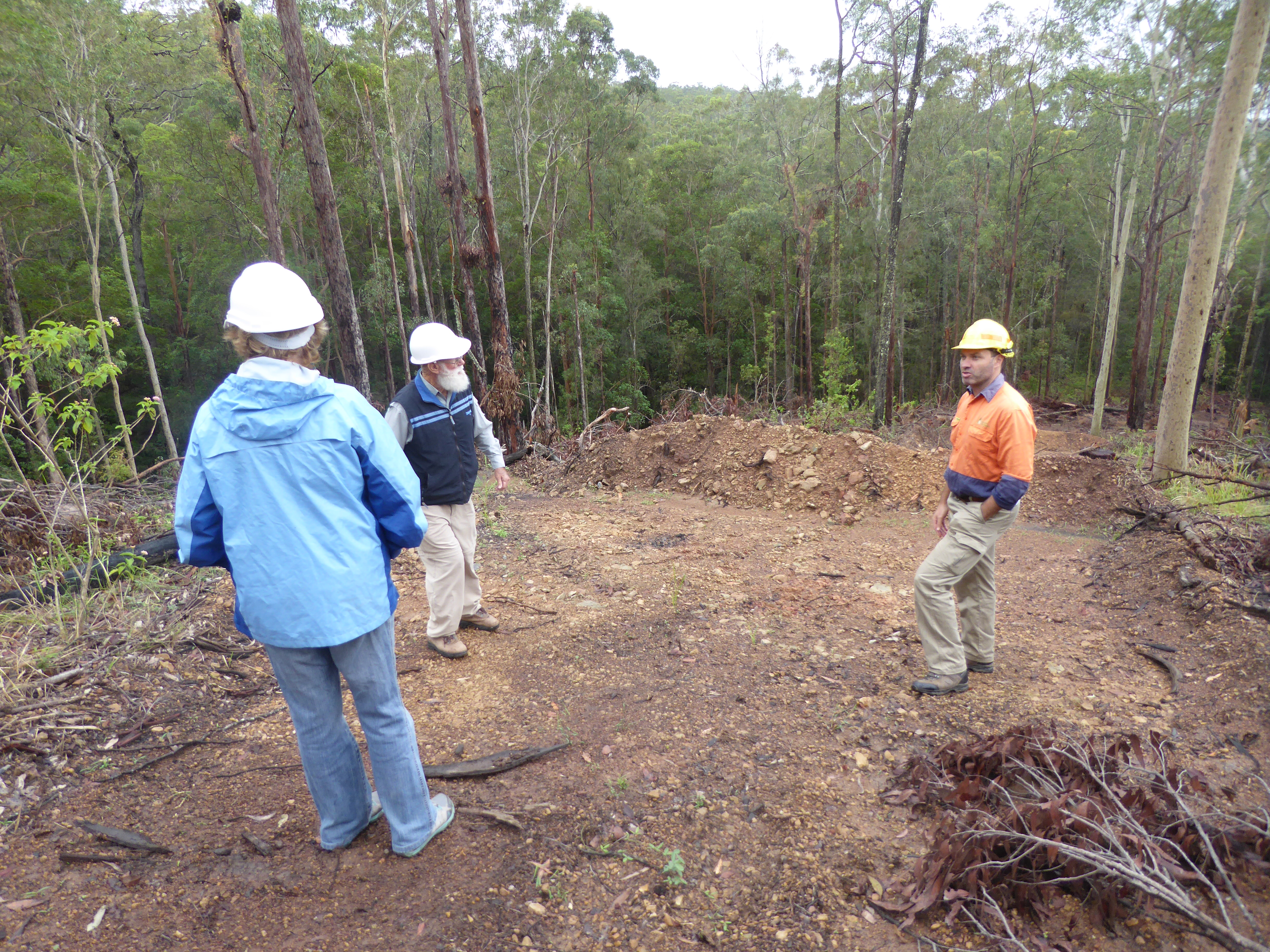
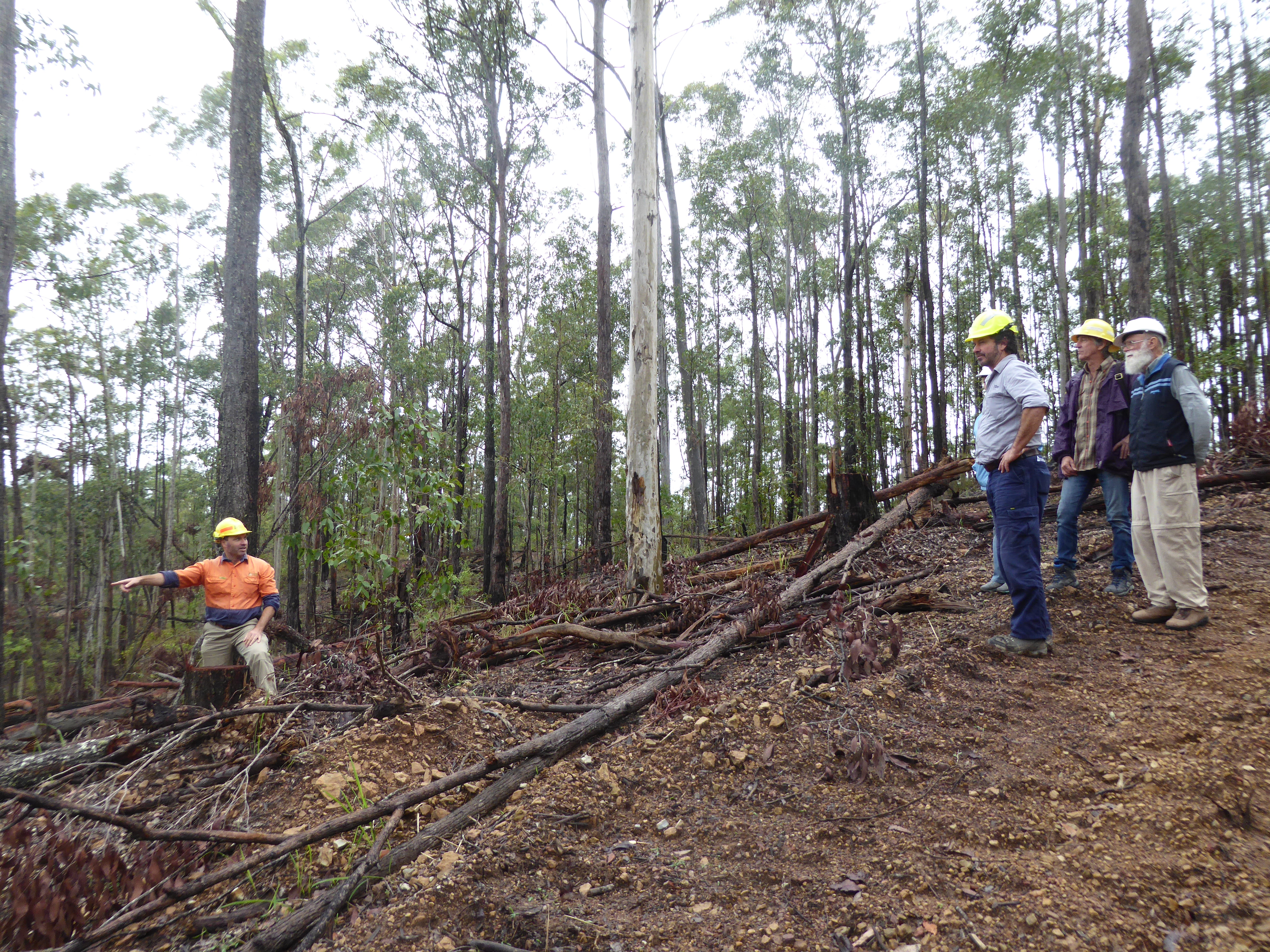
On Tuesday 2nd April; Christa, Denise, John and Rupert attended a site visit to selected Forestry Corporation NSW recent intensive operations and regeneration sites, with Peter Walsh (Soil and Water), Justin (Forest Operations Planner) and Reece (Field Manager).
It is important to understand that FCNSW manages 4% of the Macleay catchment, significantly less than our southern neighbours in the Hastings, and the Nambucca and Bellinger catchments to the north.
SOMR was informed that improved mapping software and improved “walk over” machinery allows for the selective harvesting of timber, with minimal damage to the immediate environment.
The Environmental Protection Authority has a team dedicated to monitoring forestry operations, every machine operated by FCNSW is GPS tracked in “real time”, allowing the EPA to access precise data on the location of operations.

SOMR members with Forestry Corporation officers in Tamban State Forest

It was explained that the reduction in riparian buffer zones from 10 m to 5 m will also have little impact on sediment in waterways. There is a 10 m “No Go” zone as well as the buffer and use of the “Walk Over” machine minimises soil disturbance. Operating distances from waterways vary according to stream ratings.
Forestry operations are planned to minimise erosion, snig tracks and access roads are stabilised using cross bank constructions (up to 0.5 m) when operations are concluded. The extent of erosion control is based on the analysis of slope and soil type.
There are concerns regarding the impact of private logging, connectivity for wildlife corridors and the development of monoculture plantations, however these are not under SOMR’s remit, which is exclusively on water quality in the catchment.

Viewing cross bank construction

Future directions include FCNSW use of drones in field management, the inclusion of FCNSW representation on the Macleay Contamination Working Group and SOMR plans taking a look at the ‘Non-Regrowth’ operations in the Styx River area, scheduled for this year.

Paddle 2018 – Experiencing the Yarrahapinni Wetlands

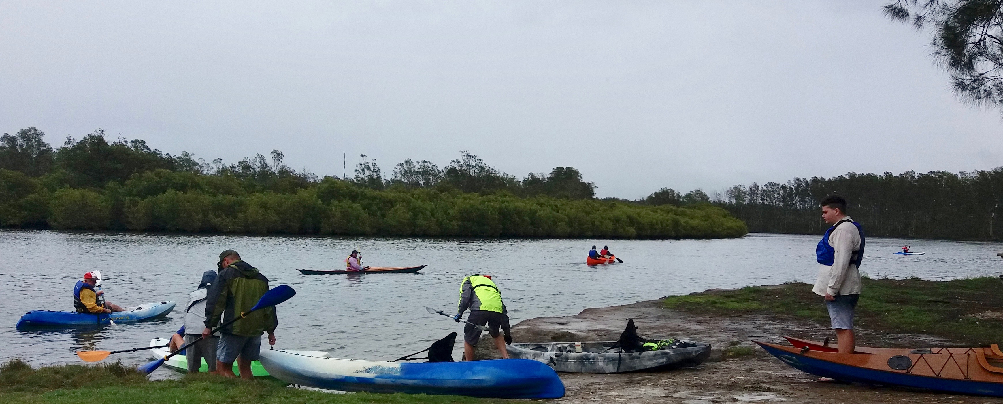
Braving cool showery squalls, about 20 intrepid paddlers formed a small flotilla of kayaks and canoes to enjoy the SOMR ‘Paddle on the Macleay’, to see the results of the restoration of Yarrahapinni Wetlands.

Save Our Macleay River Inc. (SOMR) were delighted to host and organise interesting stories from stakeholders about the return of the Yarrahapinni Wetlands to its natural state as a salt-water fish-nursery with regenerating mangroves. Almost 50 years of blockage of salt water and drainage, which released frequent and extreme pollution events, resulted in frequent oyster damage and fish-kill events. The return of the Wetlands being “alive again”, was found interesting and much appreciated by these hardy paddlers.

Congregating in light rain at the Golden Hole, Elder Uncle Neville Donovan welcomed the paddlers to this significant Aboriginal area.

Oyster grower Todd Graham greeted the paddlers and described the positive effects of the natural salt water flow in the Wetlands on the health of the river. Besides using improved breeding stock in recent times, the clean water has greatly contributed to oysters maturing very quickly. Unfortunately, black water events from the adjacent Clybucca Wetlands are still occurring with lethal effects on the oysters. The restoration of the Clybucca Wetlands is eagerly awaited.

Launching the boats at the Golden Hole

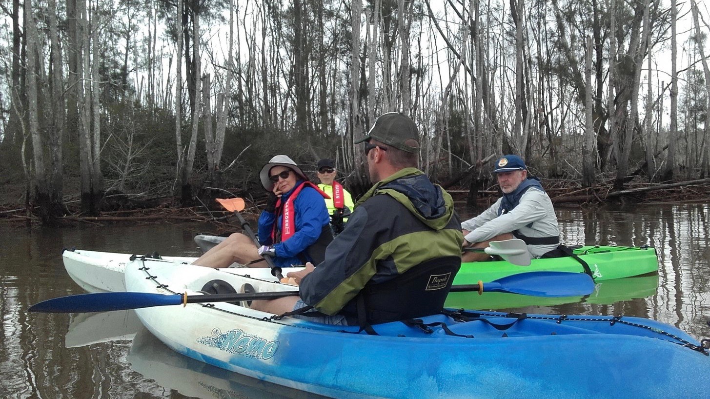
When entering the wetlands, with the almost high tide carrying them, the paddlers saw salt water pouring in, two to three-metre high mangroves establishing, an abundance of pelicans, cormorants, herons and other birds feeding on fish and even the regeneration of ‘sea-grass’ on the margins of Middle Island.

Paddeling into the Wetlands

Going up into The Broadwater, the real expanse of now established fish nursery habitat unfolded. The edges and low islands are strongly tinged with the light green of regenerating mangroves. To the east with a steeper bank is the coastal rainforest, believed to be on top of a part of one the largest recorded ‘Middens’ in Australia.

Going further up, young mangroves were seen in what used to be fresh-water reed ‘side-swamps’, now covered in salt water. After about 1.5 to 2km up, the mangrove regeneration became patchy, but there was one mature mangrove that had surprisingly survived the 45 years of fresh-water!

At a distance of 2-3 km from tidal salt water in flow, the paddlers could see that significant rehabilitation in this area will take time. Small areas of ‘Salt-Marsh’ regeneration are develop ing on the edges of the old and dug ‘channel’, but the dead fresh-water vegetation looked like a bomb zone!

The intrepid paddlers stopped for a ‘lunch-break’ at the site of ‘The Scalds’, some 3.5km up the Wetlands before returning. As the name suggests, this was a large area of Acid Sulphate surface soil scalds, releasing sulphuric acid and pollutants into the Macleay River Estuary every time it dried out and rained again – destroying fish, oysters and tourism.

Relaxing at the lunch break, listening to Matt Wills from NPWNSW

During the lunch break, paddlers were interested to hear from National Parks and Wildlife Service’s Matt Wills, of the next steps in the Yarrahapinni Wetlands rehabilitation. It is planned to remove further parts of the ‘levee’, fill-in the remnant ‘flood gates’ and undertake revegetation and bank stabilisation activities; thus restoring the wetlands close to its prior culturally significant and natural state.

Returning to the Golden Hole, most participants just let their boats drift, a most peaceful experience.

It was generally agreed by the paddlers, that this was one of the few ‘success stories’ for rehabilitation of a significant wetland and a boost to the reduction in damage to the environment, economy and tourism from past practices.

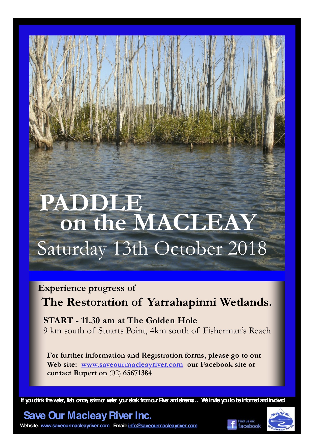
Paddle on the Macleay 2018

On October 13th, Save Our Macleay River (SOMR) will hold an event to promote awareness of developments and progress of the restoration of Yarrahapinni Wetlands and reduced Acid Sulphate and low dissolved oxygen pollution, as well as create an awareness of Antimony/Arsenic hot spots on the Lower Macleay

Bring your canoe, food and water for an informative, enjoyable day on Saturday October 13th to the Golden Hole 10km south of Stuarts Point by 11.30am.

Paddeling the little known Yarrahapinni Wetlands, participants can witness the restoration from artificial freshwater wetland to its natural salt water one and see the change in vegetation from Swamp-Oak to Mangrove. The re-introduction of tidal salt water has resulted in a massive reduction in Acid Sulphate and low Dissolved Oxygen pollution from the wetlands area and resulted in restoration to a significant fish nursery habitat.

The paddlers will also hear about the proposed Clybucca Wetlands restoration with similar issues, as well as Antimony/Arsenic impacts on the river and ‘hot spots’ in the estuary flood-plain.

The Paddle will go from The Golden Hole launch area, 9km south of Stuarts Point, to the top of the tidal extent of the Yarrahapinni Wetlands National Park and return the same way. The Paddle starts through the ‘Broadwater’, winds up the narrowing Borigalla / Barraganyatti Creek, past the old ‘Scalds’ area and up the old cut drain to the Whalan’s Bridge Area.

  • Paddle is about 5.5km each way, with incoming and outgoing tide, estimate about 1.5 to 2.0 hours each way.
  • Registration Form: Available below (scroll down to end of this post) and on facebook for pre-filling or completion on the day.
  • Registration Fee is $5.00 per person – to cover insurances – payable at registration before launch
  • Paddlers to bring safety equipment of life jacket, hats, sunscreen, insect repellent etc.

Due to inaccessibility

  • Paddlers to also bring: All food, water/drinks, etc as the area is too inaccessible for SOMR to provide same
  • No toilet ‘facilities’ will be available, paddlers need to follow appropriate bush/camping protocols.

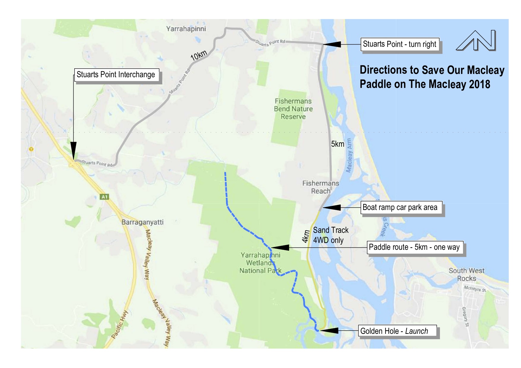
Directions to The Golden Hole launch area for the 2018 Paddle

For pdf print version scroll to end of this post

  • Coming north or south on the Pacific Highway (A1) exit at the Stuarts Point Interchange and from the eastern roundabout take the Stuart’s Point exit.
  • Follow the signs to Stuarts Point and at the end of the road though the village, just past the shops, turn right toward Fishermans Reach for approximately 6km on bitumen road to the Boat Ramp area – where the bitumen ends!
  • At this point, there will be SOMR representatives to provide detailed directions. If 4WD drivers’ can; please offer to assist with transfer of those with 2 WDs.

For those with 2WDs or those wishing transport to the Golden Hole – Arrive at Fishermans Reach by 10.30am:

  • Stop here and find a safe parking area, that will not obstruct others or residents.
  • Approach a SOMR representative and ask for transfer to the Golden Hole launch-site.
  • Please ensure you have gathered ALL your ‘necessaries’ for easy loading, as asked by a SOMR representative. (This to include: hat, sunscreen, life jacket, water, food, car keys, $ for registration fee, etc. – And of-course your canoe and paddle!)

For those with 4WDs, directions will include:

  • Continue past some houses on the right and keep going take one of the sand tracks under the powerline for about 3.5km.
  • At the fence-line, take the right-hand track into the Yarrahapinni Wetlands National Park westwards. (Please do not leave this track. – To protect the highly significant ‘middens’ in this area.)
  • Continue along this track until you reach ‘The Golden Hole’ and please park as directed, for assembly prior to launch.

Click for print version of indemnity/registration form with info summary Paddle 2018 Registration/Indemnity and DirectionsMap2018