While SOMR is primarily concerned about the impact of the pumped hydro scheme on the Macleay River, at this stage of the development it is most important that the community is correctly informed on a number of issues.
In a recent interview reported in the online and print editions of The Macleay Argus, Melinda Pavey, MP for Oxley, encouraged the Macleay residents “to learn for themselves” about the Oven Mountain Pumped Hydro project. The problem is that many ‘facts’ in the interview were not correct; adding to the misinformation in the community. It seems neither Ms Pavey nor the Argus reporter have checked their facts.
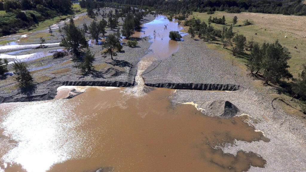
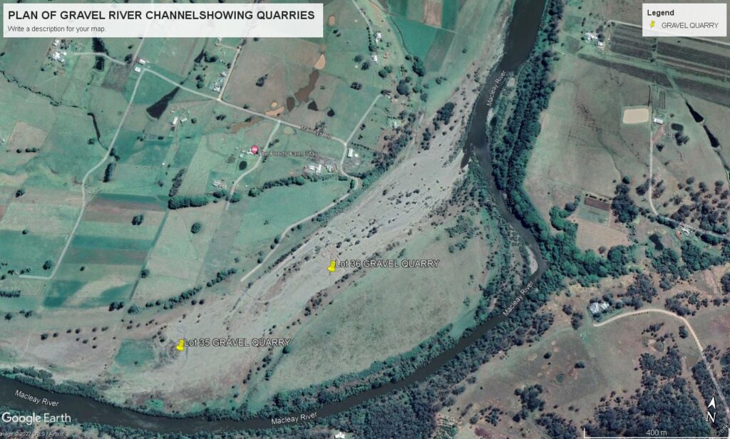
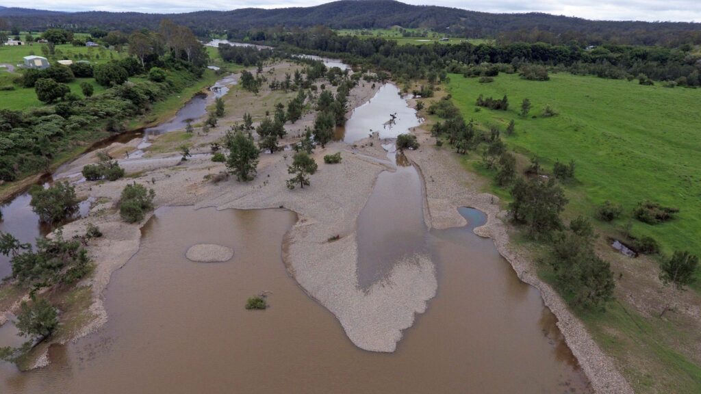
The two quarries are located in an existing gravel flood-channel of the Macleay River, which fills with water with a river rise of about 2.5 meters. This then forms a large island of about 20 hectares between the flooded channel and the lower river channel. The velocity of the water flowing though the quarries, increases with the rise in water level until it matches the main river flow. (Refer Images 1 & 3 below.) When the river height reaches about 10 meters the whole island (right hand side of Image 2 below) is covered by water.
The Development Approvals for the quarriers were issued by Council in 1997, with only six Conditions relating to extraction of the gravel and compliance with Department of Water Conditions. This; in-spite of the long existent NSW State government Policy, ‘The NSW Sand and Gravel Extraction Policy for Non- Tidal Rivers’ (1992).
The ‘Approvals’ were issued under “Existing Use Rights” as the quarries had been operating for several years and excavation was limited to the existing approved area. The Environmental Planning and Assessment Act defines Existing Use Rights as: “One which began legally but would now be prohibited”.
The quarries have been operating under the 1997 Approvals for about 25 years and, to the best of our knowledge, there has never been an Environmental Impact Study carried out to assess the environmental impact the quarries on the Macleay River including: river morphology, antimony and arsenic mobility, as well as the fish and wildlife that are part of the local ecosystem. Or addressing any of the 6 mechanisms identified in The NSW Sand and Gravel Extraction Policy for Non-Tidal Rivers’ (1992).
SOMR’s concerns are that the continued operation of the extraction is creating a deep channel in the gravel bed, approximately 2 meters deep at the upstream end. As water flows over this excavated edge, it erodes the gravel bed further upstream and changing the water flow within the existing gravel bed. (Refer Image 1 below.) The extended reduction in the height of the existing gravel bed then has the potential to continue to extend upstream from the excavated area, potentially meeting up with the main river flow channel and changing the river course.
As there is no set length of time within the DAs for the quarries to cease operation, the question is, how long can the quarries continue to operate without complying with current environmental requirements? There have been numerous breaches of the DA and Licence Conditions over the years which have been ‘overlooked’ by council and the annual inspection by the understaffed Department of Water (now National Resource Access Regulator).
We believe that now is the time to urgently review this situation of operating under historic and out-dated “Existing Use Rights” Approvals and 1997 Conditions, given; the increased number of flood events impacting the Macleay River, due to climate change and the increased potential for major impacts on the stability and health of the river and those people and industries impacted.
1. A knick-point developed as a consequence of steep-batter quarrying eroding upstream from the quarry face following flooding, impacting on the natural rates and magnitude of change in the gravels of the flood channel; 6th Aug 2021.
2. Site of gravel quarries lower centre- left of image.
3. Flooded quarries showing extraction is affecting the active upper river channel of the river.
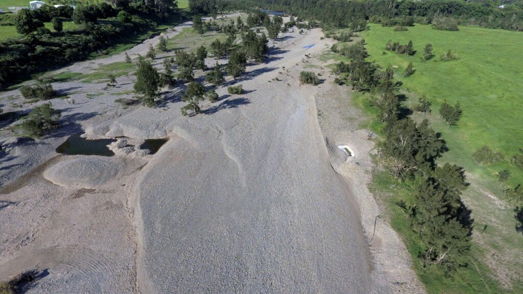
4. Gravel movement from upstream erosion after flooding; 20th Dec. 2021.
Footnotes:
The above is a summary only, as to include all the information on file (copy of DAs, correspondence with Council and Department of Water. Images of Quarries etc) would create a very extensive article) Some images have been included to show the location of the quarries, the extent of the excavation and the altered water flow being created by the operations.
An assessment of the ‘Turners Flat Geomorphological Context’ is linked to this article:
3. A relevant extract of the “Sand and Gravel Extraction Policy for Non-Tidal Rivers” (1992) is also linked to this article for further background information:
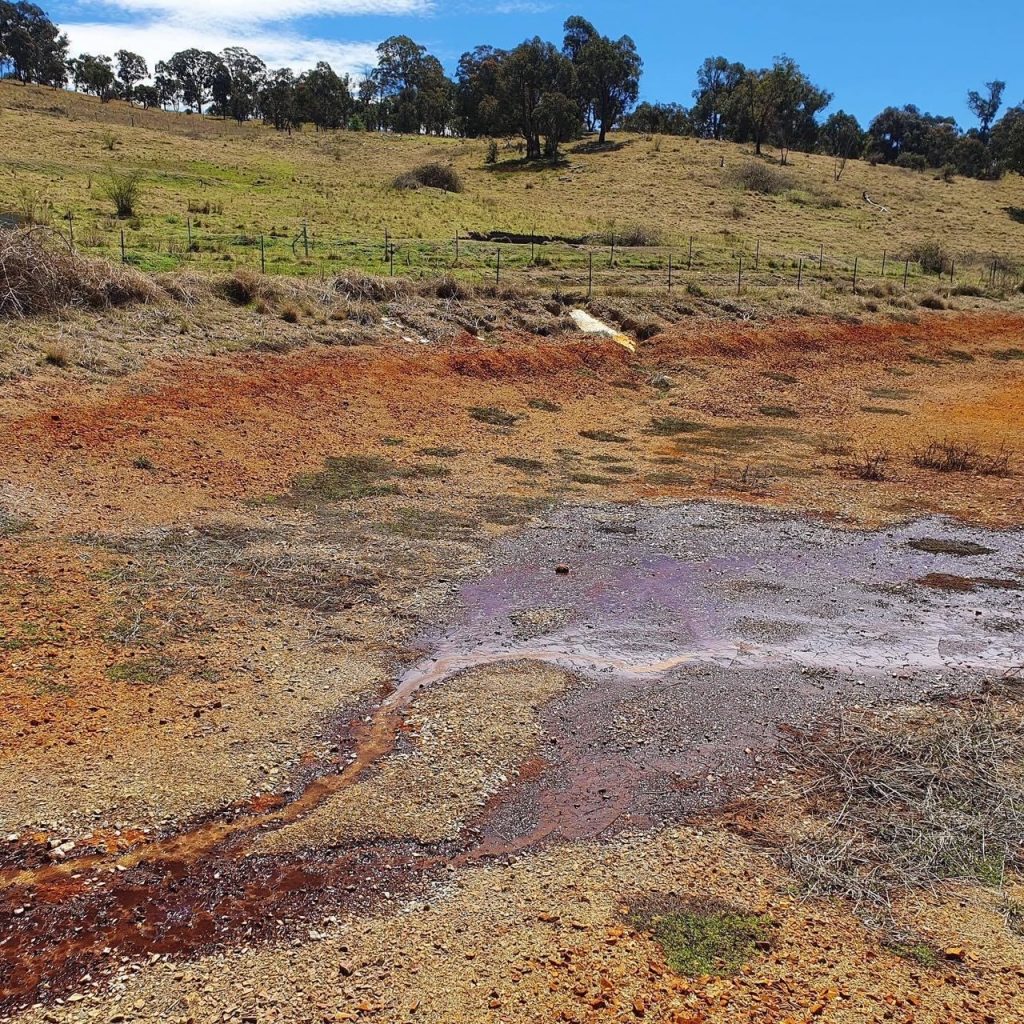
Unacceptable mine “rehabilitation” In Comet Vale, part of the Macleay catchment – this shows water coming out of the shaft on the left (a metre inside the lease boundary). The water then travels off lease down the slope and disappears into the base of the dam which has been rebuilt to ‘not leak’. The white patch mid-top is the mesh which is part of the ‘water proofing’ of the dam.